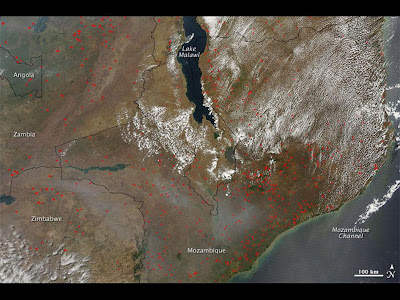
Fires continued to burn around eastern Africa’s Lake Malawi (Lake Nyasa) on October 13, 2009. The Moderate Resolution Imaging Spectroradiometer (MODIS) on NASA’s Terra satellite captured this true-color image the same day. The fires were likely set for purposes of agriculture, a common occurrence at this time of year.
Red dots indicate hotspots associated with actively burning fires, which burn all around Lake Malawi. Beige-gray smoke plumes occupy a roughly east-west band through Zimbabwe and Mozambique, south of the lake. Although the smoke almost certainly results from the regional fires, only a few source points for smoke plumes appear in this image.
Red dots indicate hotspots associated with actively burning fires, which burn all around Lake Malawi. Beige-gray smoke plumes occupy a roughly east-west band through Zimbabwe and Mozambique, south of the lake. Although the smoke almost certainly results from the regional fires, only a few source points for smoke plumes appear in this image.